Maps
Interactive online maps are in the making!
For the time being, here are some static maps for general orientation.
(Clicking on the maps gets you to hi-res images)
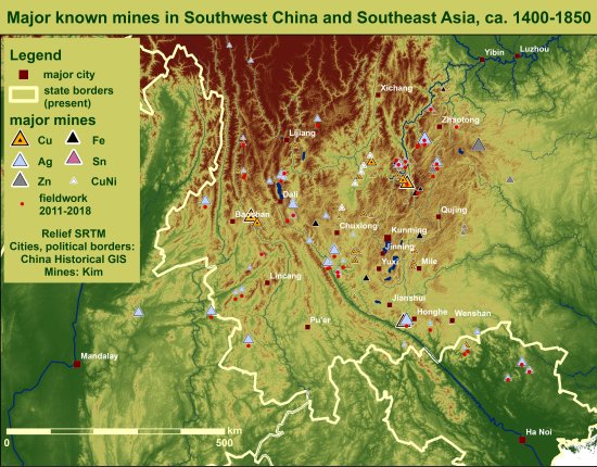
The maps below show 126 known and geolocated major mines that were worked in the period between 1400 and 1850. They serve for general orientation. Interactive maps are in the making and will become available in spring 2020.
Please note that
- the maps are not exhaustive and show important mining areas only, in some cases with one name referring to several sites.
- the coverage of copper, silver, tin and zinc is much better than for iron for the simple reason that the identification of historic iron mining is only in its very beginnings.
- the symbols indicate the main metal worked at a site, e.g. indicating silver where silver, lead and some zinc were worked, as lead was the metal used for the extraction of silver and zinc smelting a sideline during the declining years of the mine.
Northeastern Yunnan and western Sichuan


Southern Yunnan and northern Vietnam

Western and northern Yunnan, and northeastern Myanmar

Last edited by:
Nanny Kim
Latest Revision:
2024-02-29


